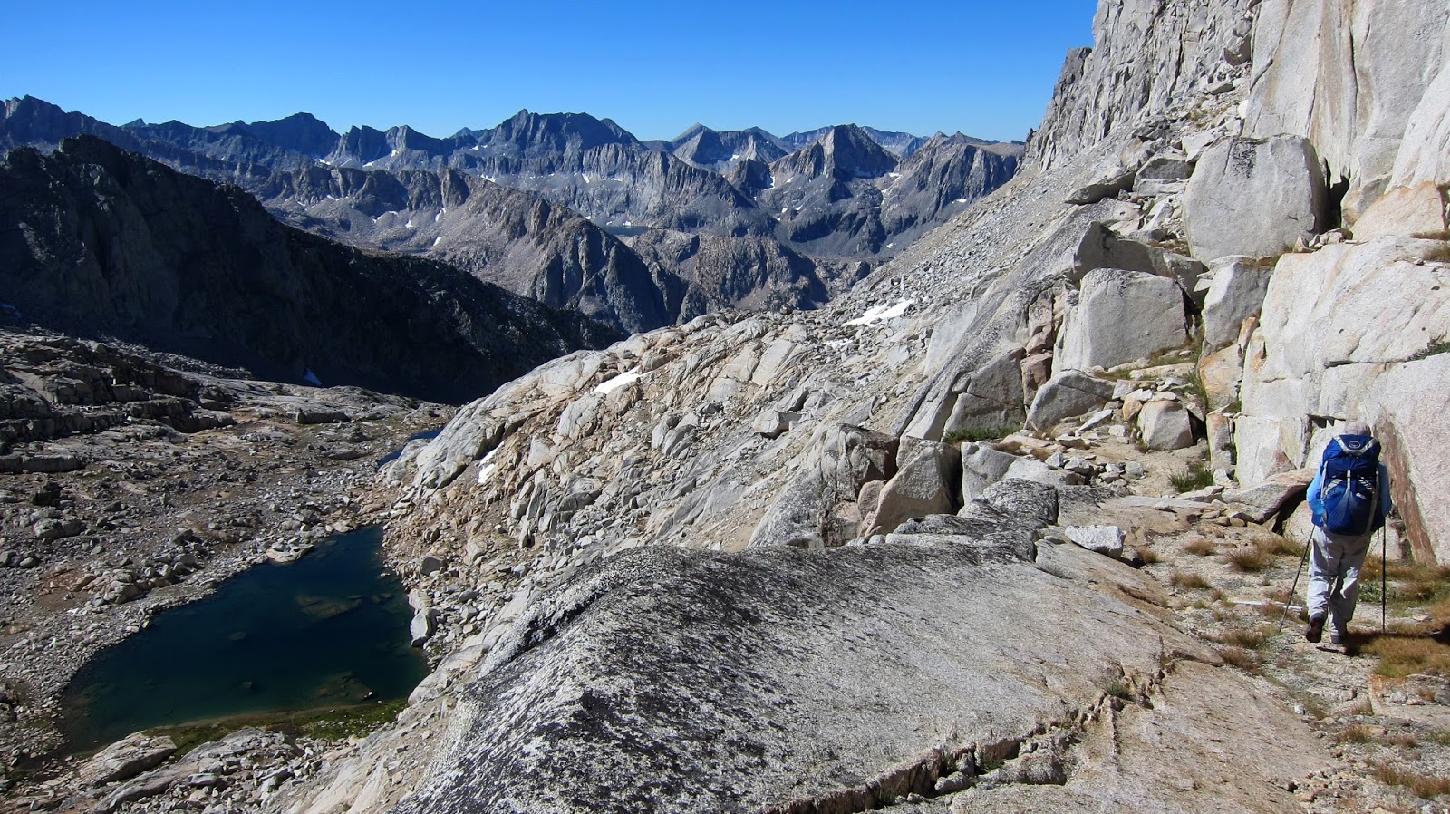
Day 16 was one of our hardest days. By late morning, we had bumped into two coyotes (right), picked up our food drop from Jeff at Piute Pass (who had very conveniently arrived over an hour earlier), and headed past Muriel Lake and Goethe Lake towards Alpine Col. There are three high crossings over the Glacier Divide: Snowtongue Pass (as suggested by Roper, followed by Andrew Skurka and avoided by many!), Alpine Col and The Keyhole. We opted for Alpine Col (at 3768m/12362ft a little higher than Feather Pass and a little lower than Snowtongue Pass), though we had met folks describing it as traversing rocks the size of Volkswagen Beetles! Turns out they were right.

Even getting to the base of the ascent is hard work, as Goethe Lake is lined on the eastern side with rocky Beetles. Having clambered over those, we still had climb 240m/790ft of boulders, talus and scree to pass through Alpine Col (pictured left). Yet more talus and picking our way over boulders, and we found our way to Darwin Bench, a real oasis after all the earlier rock. Even though we spent nearly 11 hours "on the track" (including picking up and packing our food), we barely travelled 12km/7.5mi. We climbed 832m/2730ft and descended 263m/2500ft. But the terrain was some of the toughest of the whole hike, and of course with freshly laden packs!
Next day we made a quick visit to Darwin Canyon before dropping down to the JMT on an at times indistinct trail that then improved so much we thought we were
already on the JMT! We proceeded to Evolution Lake (right), one of the prettiest lakes on the whole hike.
Beyond it was another pretty lake, Sapphire Lake, and the gorgeous Wanda Lake (left), named after one of John Muir's daughters. We had wanted to camp there, but couldn't see anywhere (there's one spot on the opposite side, apparently, but no trees), so we pressed on up to Muir Pass (3644m/11955ft), which crosses yet another divide, the Goddard Divide. The "Muir Hut" is a shelter built at the pass, which would be a good port in a storm.

From Muir Hut, it was less than an hour down to Lake Helen (another of Muir's daughters), where we found a pretty (though bare, as is usual above the timberline) campsite. At 3561m/11683ft, this was to be the highest campsite of the whole hike, higher even than Guitar Lake below Mt Whitney.

Day 18 commenced with a descent effectively following the Middle Fork of Kings River from the headwaters at Helen Lake down Le Conte Canyon. A beautiful (and tall) descent it is, too, dropping 1049m from Helen Lake to Little Pete's Meadow, where we gave ourselves the afternoon off. This was our first half day of walking (ignoring ending the northbound leg, and starting the southbound leg) and we welcomed the rest. We also welcomed all the interruptions as several grouse (or ptarmigan), a mule deer and her faun wandered through the campsite. Little Pete's was a good place to stop, as we enjoyed a mid-afternoon sunset due to the proximity of Langille Peak, which towered 970m/3180ft above us, casting a welcome shadow.
The start to day 19 was really well engineered, as we had a steep 600m/1968ft climb up to Dusy Basin. With an early enough start, we accomplished all but the last ten minutes in the shade of the valley wall.
 Dusy Basin was pretty enough, though starting to feel the mid-summer heat. However as we were climbing up to Knapsack Pass (the gap about dead centre above, just right of the largest peak - Columbine Peak), we were visited ad hoc by an iridescent hummingbird, which flew up to us, inspected us, said "what are you doing here?" and then flew off. A magical moment.


Knapsack Pass was one of the easier passes (we made it a bit harder by diverting from the straight-up-the-middle route to go a nearby tarn for lunch), and we made camp at one of the Barrett Lakes, having just put back on all the elevation we had lost the previous day. We watched the light change on North Palisade (left) as the sun set. Not long after, the moon rose. And then much later, the sun (right) rose...
Day 20 crossed two passes, Potluck Pass and Cirque Pass - both interesting in their own ways. Potluck Pass (left) had a very steep southern side, starting off with a ramp which basically devolved into a scree-ride. Cirque had a choose-your-own-adventure route which was largely easily navigated, descending to our campsite, a white knoll above the JMT and west of Palisade Lakes.
Now at the two thirds way mark, we dropped quickly down to Palisade Lakes, only to immediately commence the 450m/1475ft climb to Mather Pass (pictured right - with the Palisades and Palisade Lakes in the background). At the bottom of Mather Pass, we were to part ways with the Sierra High Route (which was to head south-west to Kings Canyon) and follow the JMT/PCT (roughly southwards, with some side diversions) towards Mt Whitney.
Having turned from the Sierra High Route and toddled over to Split Mountain tarn, we contoured along a variety of benches to Cardinal Lake (pictured left), where we were treated to some interesting light as the sun later set, and the moon (much later) rose. Cardinal Mountain is the right of the two white "blond tips". Our little tent is tucked in on the bottom right.
Next morning (Day 22) we dropped back down to the JMT before climbing back up to Bench Lake where we had lunch. This was one of the longer days - mostly because of the side trip to Bench Lake, which added 5km/3mi, and a visit to the upper lake at Striped Mountain, which added 2km/1.5mi.

Again, we perched ourselves up in a high lake for camping, this time near Striped Mountain. We hadn't made much distance south, but really just picked our way around the Cardinal Mountain spur. We were now looking at Cardinal Mountain (left) from the south rather than the west. Taboose Pass, our next (and final) food drop, is visible to the right of Cardinal Mountain.
In this section, we travelled 72km/45mi, climbing 5050m/16570ft and descending 4980m/16340ft.
Disclaimer: The information given is of a general nature only and whilst all care has been taken, no responsibility can be assumed by the author.Conditions change, regulations change. Any reader doing these hikes after reading these notes must show due diligence and be experienced enough to take responsibility for their own decisions and actions.


 Dusy Basin was pretty enough, though starting to feel the mid-summer heat. However as we were climbing up to Knapsack Pass (the gap about dead centre above, just right of the largest peak - Columbine Peak), we were visited ad hoc by an iridescent hummingbird, which flew up to us, inspected us, said "what are you doing here?" and then flew off. A magical moment.


No comments:
Post a Comment